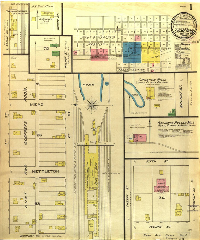
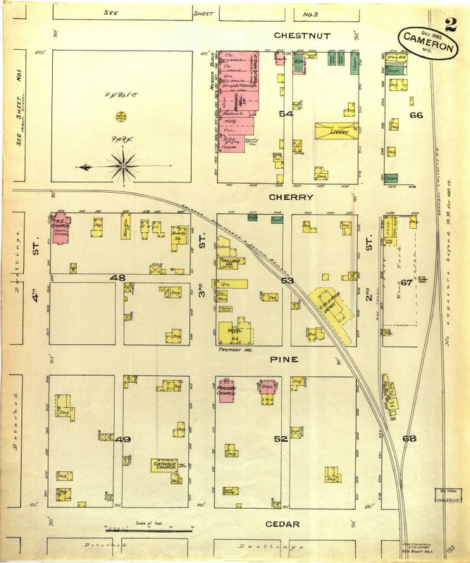
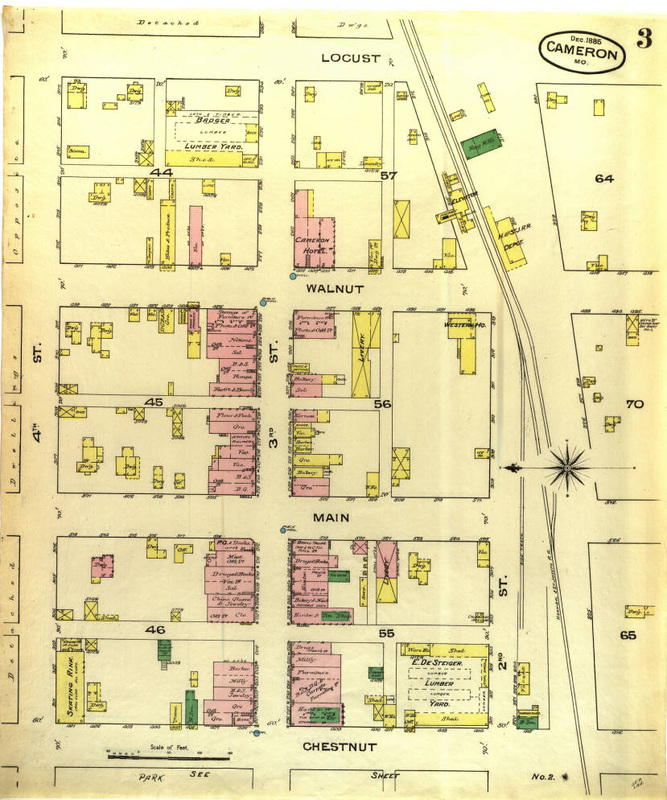
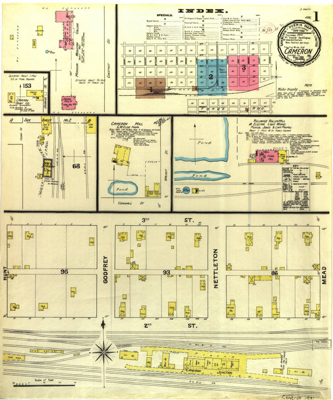
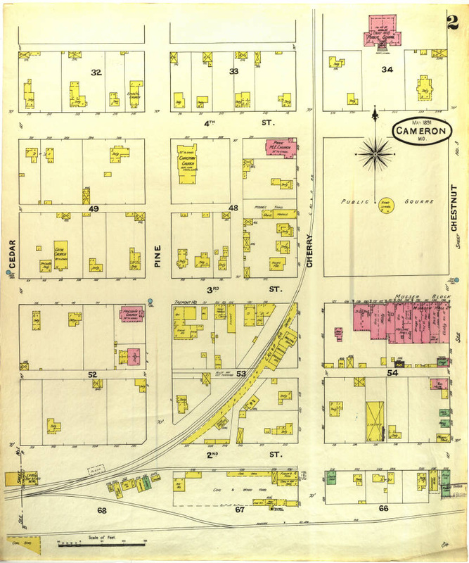
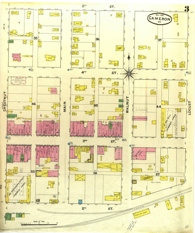
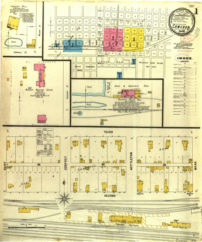
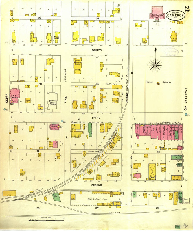
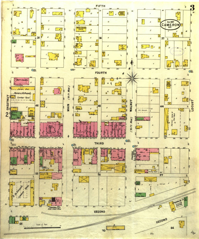
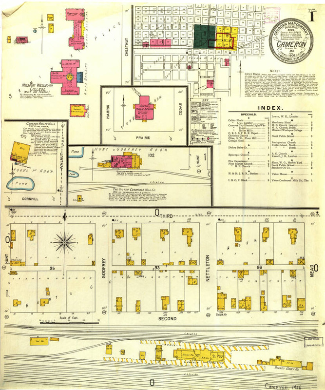
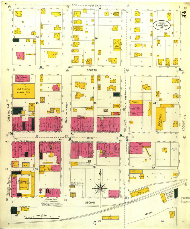
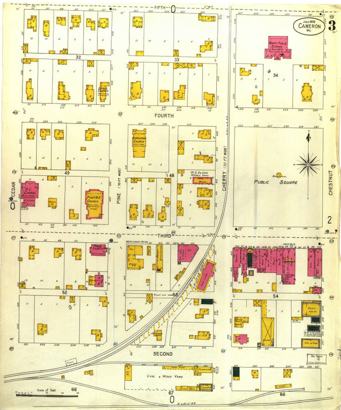
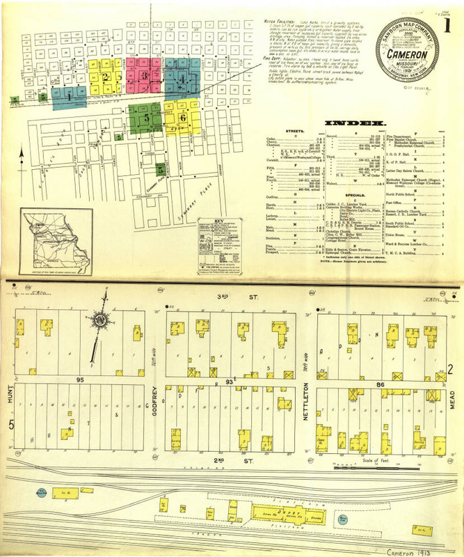
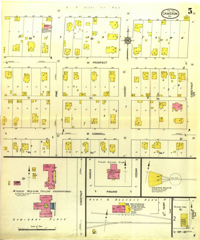
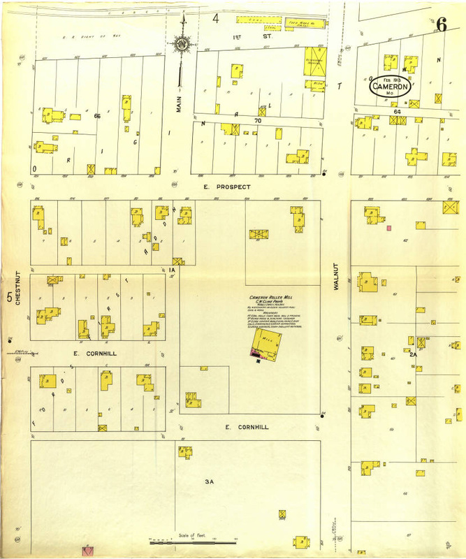
From 1885 until 1913 the Sanborn Insurance Company drew very intricate maps of downtown Cameron for the purpose of assisting underwriters. These maps have incredible detail of a growing business district. From horse and buggy days with public watering spots and very few downtown buildings through the automobile age with businesses lining all the downtown streets, these maps capture snapshots of a community just starting it's role as crossroads of the nation.
These maps have been supplied to the Missouri Secretary of State's website known as "Missouri Digital Heritage". They've been imaged in high resolution and are available when you go to the website. Click the button here to go to the index page or click any of the images below for links to individual maps.
These maps have been supplied to the Missouri Secretary of State's website known as "Missouri Digital Heritage". They've been imaged in high resolution and are available when you go to the website. Click the button here to go to the index page or click any of the images below for links to individual maps.
|
1885 Map 1
|
1885 Map 2
|
1885 Map 3
|
|
1891 Map 1
|
1891 Map 2
|
1891 Map 3
|
|
1897 Map 1
|
1897 Map 2
|
1897 Map 3
|
|
1906 Map 1
|
1906 Map 2
|
1906 Map 3
|
|
1913 Map 1
|
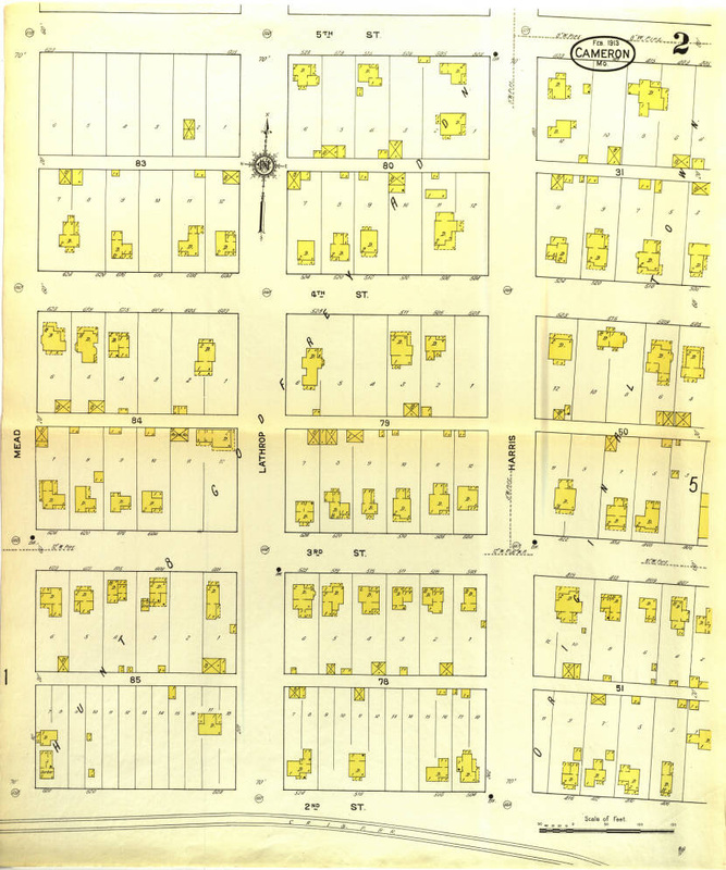
1913 Map 2
|
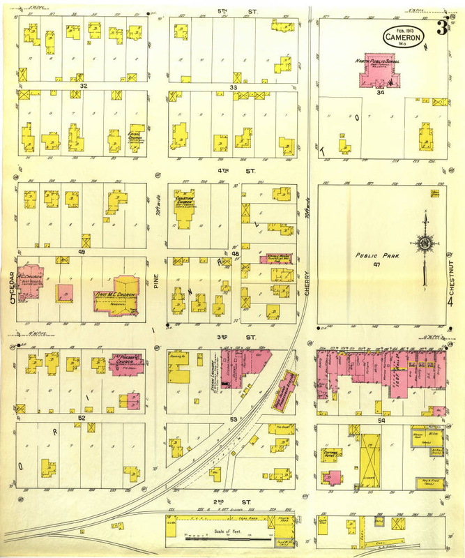
1913 Map 3
|
|
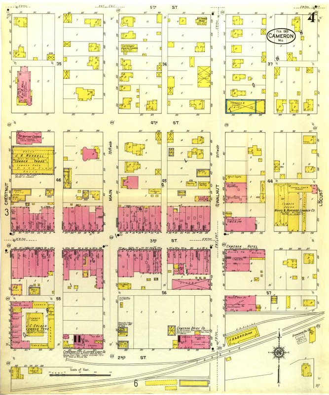
1913 Map 4
|
1913 Map 5
|
1913 Map 6
|