Cameron Missouri History
  • Home
  • Images and Archives
    • Historic Images >
      • Historic Books
      • Cameron Band 150 Years
      • Centennial Photos 1955
      • Railroads >
        • Old Railroad Images
        • Thompson RR Info
      • Businesses >
        • Business Images
        • 1910 Cameron Directory
        • 1923 Cameron Directory
        • Hollywood Maxwell
      • Schools >
        • School Images
        • Cameron Mystics
        • Missouri Wesleyan book
        • Wesleyan College OWL Yearbooks
        • Missouri Criterions and Misc
        • Faith Christian Academy
      • Churches >
        • Church Images
        • Christian Church 1905
      • Chautauqua >
        • Chautauqua Images
        • Chautauqua 1912
        • Chautauqua 1914
      • Depot Restoration
      • Commercial Club Souvenir Book
      • Death Curve
      • IOOF History
    • Dorcas Musser
    • McCorkle Documents
    • Depot Museum 2024 Season
    • Rare Maps
    • Historic Film
    • Hollywood in Cameron
    • Jefferson Highway >
      • Jefferson Highway Cafe
      • JH Google Map
      • Tourist Manual
      • 1923 Tourist Guide
      • JH In Daviess County
      • JH in Eagleville
    • Rock Island Route
  • Media
    • JHA Conference
    • Eagle Scout Project
  • About Us
  • Contact Us
  • Souvenirs and Support
JEFFERSON HIGHWAY ORIGINAL ROUTE

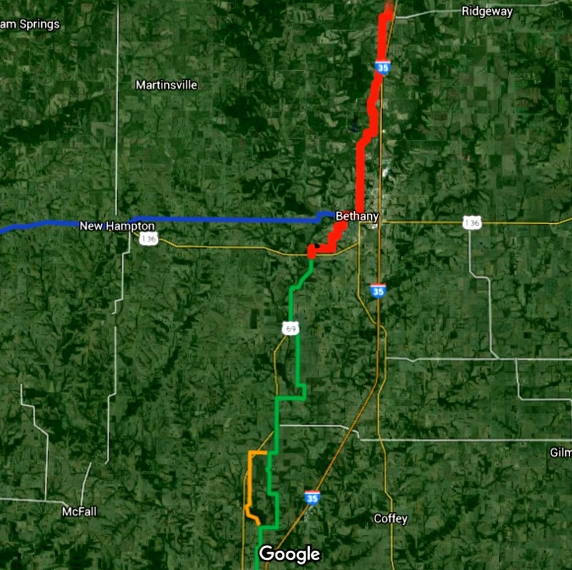
Click HERE or on the picture to the right to see a Google Map of the original route of the Jefferson Highway through North West Missouri.   The map was developed from 1917 to 1926 plat books, USGS Topographic maps and officially published Jefferson Highway maps that were developed between 1916 and 1929.  In some areas the routes changed over the years due to either improving or degrading roads.  Several of those alternate changed routes are visible in this map.
Picture
Picture
Click HERE or on the picture to the left to see a Google map of the route in Clinton county.  In 1917 the superintendent drove the entire length of the JH. He wrote down some comments about road conditions and published them in the monthly Jefferson Highway newsletter called "The Declaration"  He added specific mile measurements to his comments.  We've taken the notes and located the exact locations he was referring to.  Those notes are added as push pins on this map so you can read what the comments were as well as see the stretch of road he was talking about.
Cameronhistory.com is maintained by volunteers from the Cameron Historical Society and the Depot Museum.